Yosemite — day 1 (Mist trail)
We’ve been planning this vacation for a long time. And here we are all together in a house in Yosemite: dreams come true.
It’s nice to see snow in California in the second half of April. That’s how our day started. Although most of it has melted on a lower altitude, the mountain tops seemed to be even more shiny with some fresh powder. It made us also a little nervous because the temperature has gone below freezing in some places on the road to the valley.
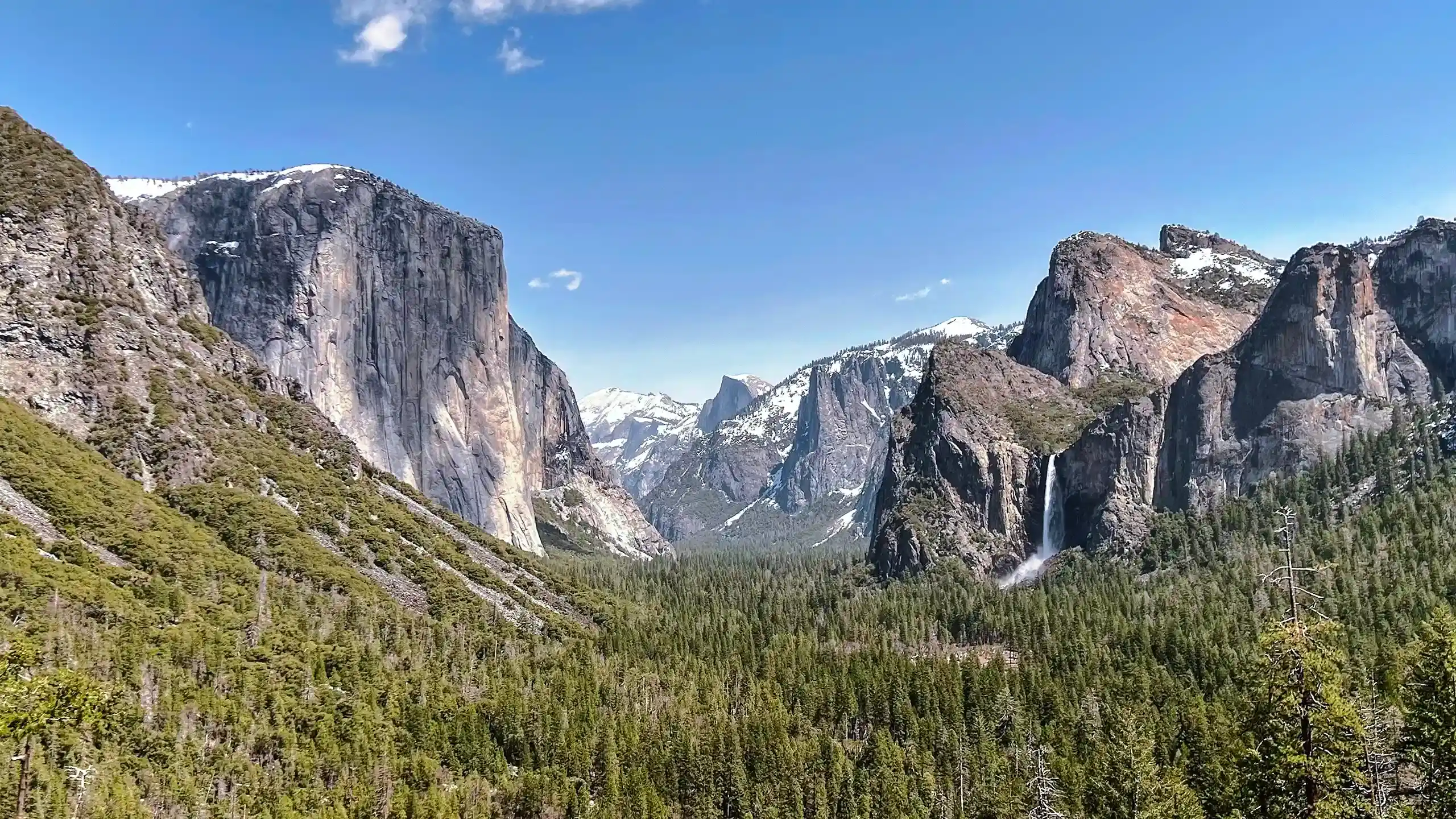
It took an hour to get to the Yosemite valley from our house in Wawona. The entrance to the valley is jaw-dropping. Regardless how many times you’ve passed through the tunnel, it keeps you amazed every single time. The granite walls and numerous waterfalls make the landscape look surreal.
But our goal for the day was not to explore the main valley, but to challenge ourselves with the Mist trail to the Vernal and Nevada falls that are further east. The hike is considered one of the most difficult, mainly because of the distance and elevation gain. You can find more information about it on this resource.
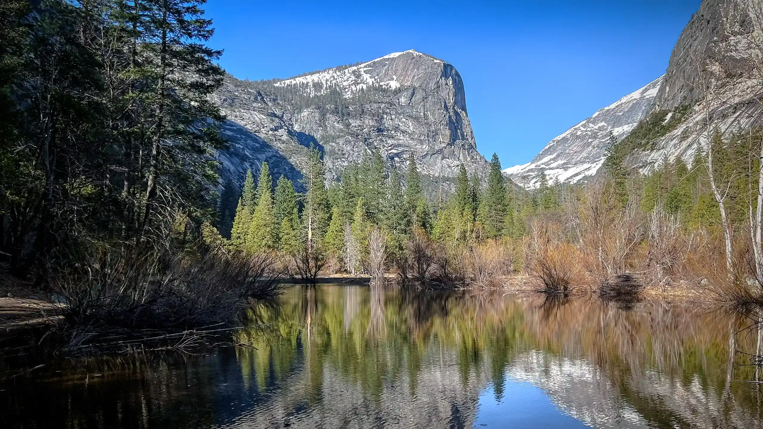
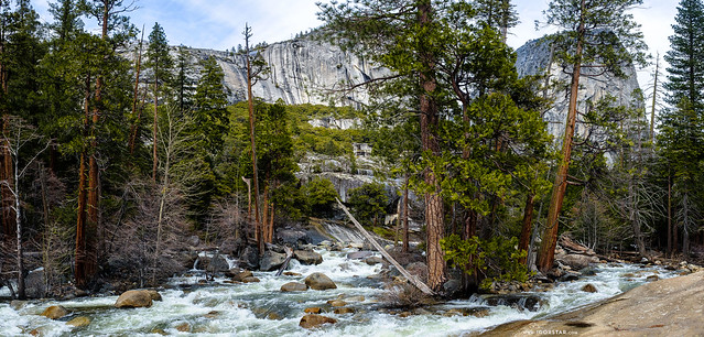
The trail started at the elevation of around 4000 feet and led us up along the Merced river — the main river that shapes the Yosemite valley. There were several bridges over it during our hike, each with a spectacular view.
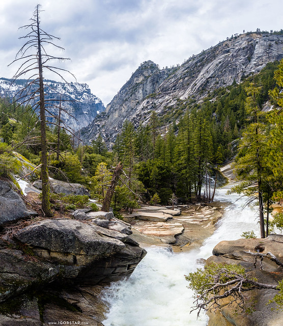
The challenges started a little later on our hike, when we discovered that two of the main roads on this hike were closed either since the winter started or because of the rock slide hazard. Because of this, the trail was no longer a loop trail and we didn’t have many options to choose from, so we continued.
After going up about 1400 feet we reached the 5400 altitude and there has already been plenty of snow. Steep snowy inclines were the most difficult part of our journey that day and took a large part of our time and energy. Many people who reached this point and saw the challenge decided to turn around. But we proceeded…
The Clark point is a lookout area from which you can see Nevada falls and three massive granite rocks: Liberty Cap, Mt Broderick and the back of the Half Dome further away.
Getting there took us 3 hours and we haven’t yet reached any of the major waterfalls that we were planning to see. So we had to hurry up.
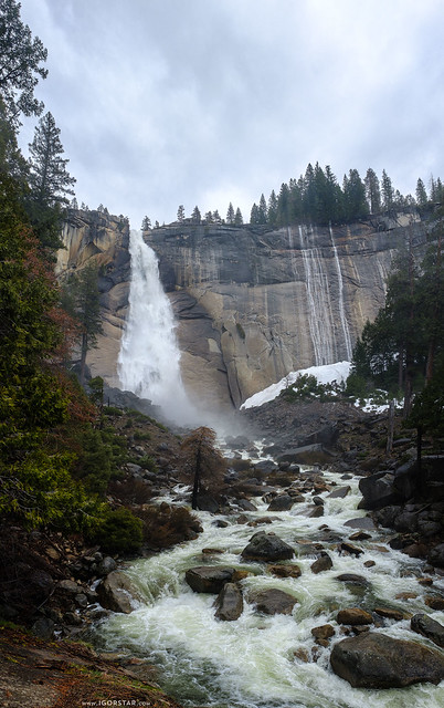
After another hour we got to the base of the Nevada falls. It was very impressive with its 594 ft drop. But for us it also would mean that we have to go up that height for almost an hour to see it from the top. Unfortunately we could not afford to do that as it was getting late.
I would definitely like to come back to this trail, maybe with my father, in a warmer season and try to get to the top of the Half Dome.
So we went back, on our way visiting Emerald pools and the Vernal falls lookout point from the top. The day was cloudy, but finally the sun started to come out. I’ve been carrying my heavy tripod without using it until now. And that was the moment that justified it as I pulled my ND400 filter to smoothen the flowing water.
The way back was difficult, but I felt fulfilled. We’ve past more than 6 miles that day over one of the most difficult hikes that I have experienced so far. When we reached the beginning of the trail, we took a shuttle bus to the place where we left our car.
In the end, the sunset gave us a beautiful good light show. As we were driving back in the valley the sun almost got entirely hidden by the mountains. But as the road went up and reached the 6000 feet, it seemed that the sun reversed it direction and went up significantly. We were able to observe the sunset twice that day.